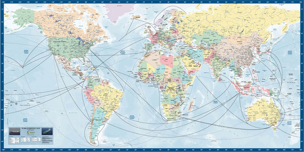
World Shipping Map - 2018
NEW - World Shipping Map.
This new to market World Shipping Map has been published by Business Maps Australia in response to the inquiry from clients over the recent past, for an up to date World map that displays quality shipping data that visually displays the global commerce patterns.
The map features the following..
- Full color political data on national boundaries.
- Detailed information on cities and towns
- Shipping routes in High / Medium / Low density traffic formats.
- The tracks are color coded for pictorial traffic display.
- Over 130 major ports on all continents in highlighted color.
- Ports are color coded to show handling of Iron Ore / Oil / Containers / Coal.
This map is designed to display all of this key information in one format, and provide businesses, commerce and the Education system with a product to compliment planning and study relating to global trade.
It will be ideal for ..
- Boardrooms and Executive offices
- Operations rooms and warehouse for shipping agents.
- Educational facilities.
- Family recreation areas.
Custom Work: The image can be produced at any required size, and we can print directly to Synthetic Paper, Self Adhesive Vinyl, Magnetic Steel, Aluminium. While the map can be printed at almost any size, we suggest sizes as practical and economical: 1600 mm x 800 mm in Synthetic Paper.
2000 mm x 1000 mm in Synthetic paper.
Please call us on 0455 296 533, or email us for more information on this unique product.


