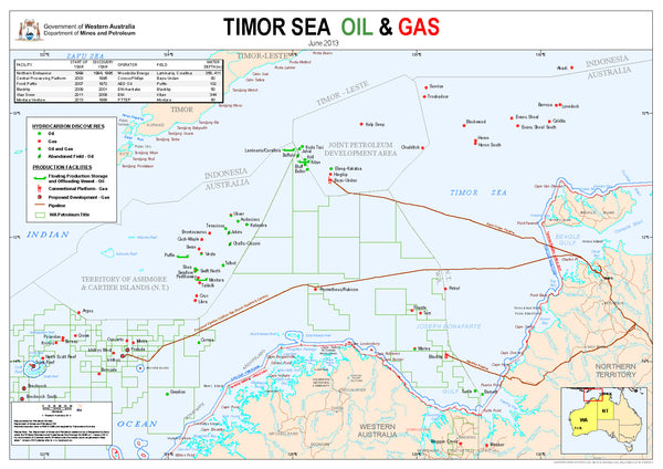
Timor Sea Oil and Gas Map
Published with data by the WA Dept. of Mines and Petroleum, and current to June 2015, this map includes the following..
- Major Hydrocarbon discoveries in this area.
- Current production facilities.
- The relevant WA Petroleum titles for the area.
- Existing and proposed pipelines systems.
The map bridges the Western Australian and Northern Territory borders, and covers the area south of Timor; west to Scott Reef in WA; and east to Darwin and Melville Island in the Territory.
Customized Versions..
This map can be produced to a variety of sizes, with company logos added if required, and mounted with framing.
It can also be direct printed onto such backing materials as foam board, vinyl, aluminium and magnetic metal.
Map supplied.. 950 mm x 690 mm Laminated.
Data courtesy of WA Dept. of Mines and Petroleum.


